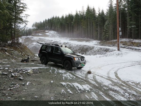
A killer work week left me too drained to organize a trip. So Saturday morning I headed out from Vancouver at 8:30 AM - destination Watersprite Lake. With an avalanche rating of considerable in the alpine I was not sure I wanted to ski Martin Peak solo. The road was plowed to the Skookum generating plant. Above that, the south-facing slopes leading to Watersprite Lake winter route were bare of snow. I drove to 800 meters and parked about 300 meters short of the trailhead proper. There was enough snow on the road above that to discourage any adventurous 4WD maneuvers. It was just after 10 AM. Skins on, I was able to ski tour from where I parked.
The winter route was in good shape. Some additional clearing of alder in the first kilometer would be of benefit but generally the route was covered and did not require any acrobatics to ascend. Of interest was that there was no evidence of mechanized activity beyond the trailhead. At 1000 meters, the snow depth was approximately one and a half meters of very dense snow. The previous week brought about 30 cm of powder which became denser near the top. It was not ideal for trail breaking but neither was it impossible. It took about 40 minutes to climb to 1000 meters from the parking at 800 meters. The next 70 meters took about 30 minutes as the winter route essentially traverses towards Watersprite Creek.
As I approached the creek on the logging road I got a good view of the west ridge of Crawford Peak, which is above the notorious Watersprite Creek swamp on its north side. As my intention was to ski down the proposed Watersprite Lake summer route to the Darling Lake trailhead, it was more in keeping with my general aim than continuing up to the lake. Still, the trailbreaking up to the ridge promised to be a challenge but it is what I came for.
I dropped off the logging road before the trail branched off to the swamp. It was a short descent of about 20 meters vertical to reach the creek. There was no crossing so I took off the skis and hopped across on rocks. A stiff climb away from the creek brought me up to the first of the logging roads on the north side. The road is the planned summer trail to the lake. I followed it downstream a short distance before I saw a promising line up to the ridge crest. A bit of steep climbing on skins brought me to the higher road. I crossed it and kept going higher up the ridge. I was now just over three hours from the vehicle and at over 1400 meters when I stopped for lunch.
The terrain was quite amenable for skiing. It resembled the south face of Mount Harvery in pitch and terrain features. In other words, very good for tree skiing. I saw multiple possible ski lines ranging from 15 degrees up to around 40 degrees (maybe). The vertical extent was quite impressive. I would say up to 400 meters or even more depending on how high off the ridge the line was taken. There is also the opportunity of skiing old growth timber down the west side as the park boundary passes along the ridge. If snow conditions were good and the party was adventurous there would be sufficient terrain to keep a hut-based party fully occupied during bad weather days for at least three or four days. The existing logging roads would be used to access the ridge and put in a skin up-track. Access from the hut would require skiing down from the hut and then climbing back up again at the end of the day. I did not see the terrain as being suitable for mountain goats as the snow was too deep. I don't believe there would be a negative impact on goats from ski touring.
After lunch, I proceeded down the west ridge in a westerly direction towards the Darling Lake trailhead. Unfortunately, when I dropped two meters down the cut bank above the road, a ski binding broke. I was able to rig a strap onto the ski brake and clip it to a boot buckle and continue skiing.
The descent to the Darling Lake trailhead required crossing a couple of major creeks where skis had to be removed. It was more than annoying because of the jury-rigged ski. When I intersected the old S Line road, the snow was insufficient to cover the alder. I was forced to detour down Stas' shortcut route to the IPP road. The top part was just open enough to ski but then the trail entered the deep second growth. I was forced to walk and the post holing at times was brutal. It was entirely expected so I was not disappointed in any way.
Once down to the Darling Lake trailhead I was able to follow the ATV tracks back to the vehicle along the IPP road. Again, I was pleasantly surprised to see that there were no visible incursions by snowmobiles into the Skookum RA1 non-motorized zone. It took one hour to ski back along the IPP road to my parked vehicle. I reached it just before 4 PM giving a round trip time of just under six hours.


| Trip Report Title | Watersprite Creek ski tour |
- There are no comments yet


