Recently Added GPS Routes
Route from Parking 3B
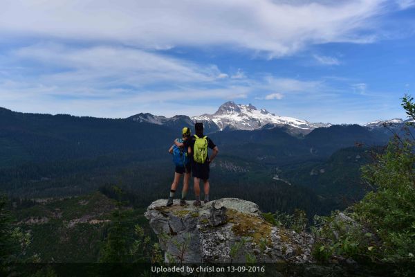
Cascades mountain accessible backcountry terrain
From Squamish:
The Mamquam River Forest Service Road (FSR) leaves Highway 99 about 1 km south of Squamish at the Apron parking lot (Stawamus Chief Provincial Park). Follow for 13.2 KM then turn left on to the Skookum Dam Road. Continue 6.6 KM to near end of road at the Dam and parking area at a locked yellow gate. AWD or 4x4 highly recommeneded for this last 6.6 KM
13.09.2016
1 comments
From: chrisl
Category: Club Maintained Trails
Tags: new watersprite lake trail
The BCMC Watersprite Lake Cabin is locked and not available to the General Public. For further information and/or reservations, please contact the BCMC at info@bcmc.caTrailhead is 20 KM east of Squamish at the Skookum Power Project Water Intake Dam. This is accessed by the Mamquam Main FSR (begins next to the Chief Climbers Parking Lot on Highway 99 just prior to entering Downtown Squamish). See separate entry for driving instructions from Squamish.
*The trail is still under construction so do not expect a fully groomed trail just yet *Time: 4 to 4.5 hours one way in the trail's current condition *Cars will not make it to the parking lot (All wheel drive or 4 wheel drive highly recommended) *Donations to the BCMC for trail maintenance is always appreciated and needed *Outhouses are soon to be constructed, and the cabin will be paid accommodation which can be reserved on the BCMC website. *Camp only in designated camping areas. *Keep in mind at all times that this area is a rugged wilderness, with unforgiving weather that changes quickly. tshirt and sneakers as an example are not recommended, proper outerware is for your comfort and safety, we want you to enjoy the outdoors. *There is a large bear population and other wildlife in the valley which is often encountered on the trail, so dogs are not recommended for the trail or Watersprite Lake. A new bear attack study indicates that 93% of all bear attacks are male bears and 53% of those involve dogs. *Human waste continues to be a major problem in the Skookum Valley and Watersprite Lake, so please do not leave your toilet paper and deeds near the lake or the trail. This will contaminate the lake and the creeks in the area and make other hikers in the future sick (contaminated drinking water from a creek on the trail already infected one hiker with bacteria) *Open campfires at Watersprite Lake are forbidden and highly detrimental to the fragile environment. **Abuse this fragile and special area and everyone loses**
This is technical, steep climber’s trail and should be undertaken by experienced hikers only. A new hiking trail gives easy access to the alpine below the summits of Yak and Nak Peaks. The trail starts not far from the Zopkios Ridge rest area on the Coquihalla Highway. From Vancouver, take the 2nd exit before the tollbooth; proceed through the underpass to the north side of the highway, then straight ahead into the upper lot where there are picnic tables. To find the trail, walk east up the ramp and start counting lampposts as you continue beside a concrete divider. Near the fifth lamppost a large stone cairn marks the beginning of the trail. At first, the trail leads down the embankment, crosses a creek which flows here in the middle of a swampy perimeter, and then enters the mature forest. The trail climbs in the trees to the tongue of a talus slope that drops from near the start of the popular 'Yak Crack' rock-climbing route. Cairns along the far (west) side of the scree slope mark the easiest ascent option. Climb to the very top of the talus where a short trail through heather gives access to the very base of the magnificent granite face.
As you turn the corner and begin to follow the trench between the wall and the slide alder, watch for climbers overhead who may accidentally dislodge small rocks. The trench holds a stream during run-off or after heavy rain. Short detours bypass the wettest and waterfall-type sections. The trail leads eventually away from the wall, cuts up through some patches of alder, and arrives at the base of a separate small granite slab. This slab can be friction climbed directly when the rock is dry, or else, a swath exists through krummholz to the left of the slab. Above this section, the route follows an obvious draw until it emerges near the foot of a hanging basin. Several large cairns and many ribbons on nearby trees mark this spot. The route becomes sketchy from here on up with the terrain wide open. So don't proceed in whiteout conditions unless you are very confident that you can find the locality again on your descent. It is a classic place where, once off-route going down, you can get into a dangerous situation.
A few more ribbons continue up through the middle of the slope, touch a corner in the vegetation, then lead toward the broad ridge. From here, it is rambling along the ridge, over a hump, and on to the summit of Nak Peak. There is no trail but the few bushes do not pose much of a problem. To gain the summit of the closer Yak Peak, hikers must be prepared to climb an intervening, permanent snowfield safely. It is only about 40m wide, but steep enough that a short slip can result in serious injury. Scrambling up steep rock on the south side sometimes avoids the snow (This snow field had melted completely during the summer of 2001). A short excursion leads left to the top of the false summit. This is a good place to get a feeling what it is like to climb the face; just don't lean over the edge too far! For the true summit, return to the broad col and ascend near the edge of the trees.
Much of the trail is covered by snow well into the summer, making this a spectacular late summer and autumn hike. It is only about two to three hours up from the cars.
Member Contact: Peter Gumplinger
Latest Featured GPS Routes