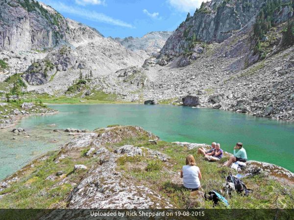
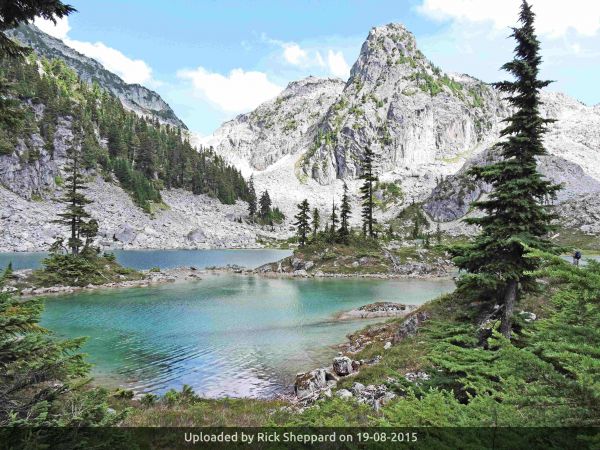
 After being inspired by the photos and trip report on WaterspriteLake in the BCMC newsletter, a group of us decided it was most certainly worth the effort of a day hike into this picturesque mountain lake. As the article noted the access was a route and not really a trail, we adjusted our expectations and allowed more time to do the hike. The hike starts steeply from the large parking area on an old de-commissioned logging road- easy going for about 45 minutes with occasional glimpses through the trees of MamquamPeaks and Garibaldi.
The trail leads off to the left from the road and can be easily missed. There needs to be more tape and/or a sign placed at this point to clearly mark the point of departure onto the trail. Luckily a mountain biker missed it the day before and had stretched a bright coloured tape across the road. Once on the trail it was clearly marked by tape and defined by an obvious footpath. However, there are many roots and rocks on it as it skirts around an open boggy field so be aware while walking. After a pleasant flat section the route angles upwards across a talus field so we had to be more observant for tape and small cairns. Beyond a forested section, there is another talus area after which the route steepens sharply until it levels at a gap between two rock cliff faces. It’s rather like a portal into a different world when we were confronted almost immediately by a spectacular view of the turquoise lake. With Watersprite Spire as a backdrop,it resembled a sublime Chinese watercolour!
Regrettably, the length of the hike (approximately 3-3/4 hours) allowed us only about an hour for lunch so we did not have the time to explore some of the high points surrounding the lake, but we will most certainly return sometime soon to this amazing scenic alpine area.
The trip back took less time and we regained the road relatively quickly after which we increased our pace down the road. There is a cautionary tale here- we relaxed maybe a little too much. Just half an hour from the car, one on the members tripped on the steep slippery gravel of the road, but instead of sliding backwards, she pitched forward on to her face and ended up with a broken nose. After all the loose talus and roots and rocks, the accident happened when it was least expected, and as we had become somewhat spread out along the road, only one person was available to render immediate assistance….so be cautious to the very end of a hike and stay together as a group no matter how easy the route appears to be-
Trip leader- Rick Sheppard
Participants- Barbara Durant, Jim and Nancy Paul, and Liz Watts


| Trip Report Title | Watersprite Lake |
PaulK wrote 26.08.2015 (positive) 1Great TR Rick. I agree with your comments on the trail. I believe we will be re-routing it to the logging road on the north side of Watersprite Creek.0 points


